Today’s adventure brought us to a a creek that, despite being only thirty minutes away, we had never visited before. A trip to this location requires all visitors to have an Eglin range pass. Located just south of the Shoal River in Crestview along Hwy 85 South is a pretty little creek known as Turkey Hen. It gets its start farther into the Eglin Reservation and flows into the Shoal River a little over a half mile from the put-in. Though the first leg of the trip is short, Turkey Hen is clear and shallow and worth the visit.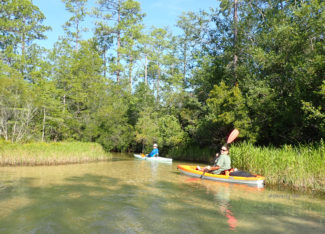
Turkey Hen launch site
The put-in location has ample parking and is a popular swimming hole for locals. We got on the cool water fairly early at about 9 a.m and started into the wetlands. The trail was easy to follow and we got glimpses of clear water running into the adjacent cypress swamp. We spotted several turtles swimming in the clear water, and sadly, quite a bit of trash that had floated down from the put-in location. There were a couple of spots that were shallow enough that we had to get out and walk our kayaks for a few dozen feet, but it was hardly an inconvenience given the scenery.
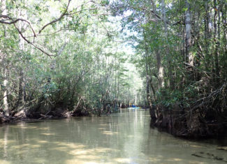
Beautiful Turkey Hen Creek
Too soon we were on the Shoal River and its darker, tannin-colored waters. It was a nice day and we were greeted by a friendly fisherman as we headed down-river. We had about 7-8 miles ahead of us to reach our take-out a short distance from the confluence of the Shoal and Yellow River. The estimated mileage is because, about 2 miles above the confluence, paddlers can choose to take a left or right branch to the river and navigate to the Yellow River. The left branch is longer but easier and passes several houses, while the right branch can sometimes be confusing with limbo logs, back-tracking and a possible portage over a downed tree. We opted for the left branch being as it was our first trip on this section of river and we were uncertain of the amount of time it would take to complete the trip.
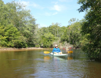
Paddlers on Shoal River
After about an hour on the Shoal, on river right, we briefly stopped at a pullover provided by a couple of friends/members from the Florida Trail association. There were two FTA trail signs marking the pull-over, but we knew to paddle just past the signs around the bend to a sandbar, dock and picnic tables. We stopped long enough to reapply sunblock, check the gps and get back on the river.
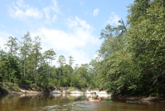
White bluffs of Shoal River
The paddle was easy going and we made good time. In places there were stunning white bluffs and in others there were aquatic plants along low-lying wetlands. We spotted several herons, a couple of red-shouldered hawks, buzzards, a few turtles, and even an owl. We made it to a fork in the river, and as mentioned previously, we took the left-hand branch. The river narrowed, but remained easy to navigate. Finally we emerged into the broad and slow flowing Yellow River.
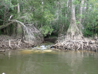
Carr Spring Branch flowing into Yellow River near Little Gin Hole take-out
Several large torpedo-shapes moved beneath the surface and it wasn’t long before one of our group confirmed my suspicions when she spotted a large Gulf Sturgeon breaching the surface of the water some distance ahead. These massive prehistoric fish have been known to injure and even kill boaters as they leap from the water so we always take care. Luckily we had arrived at our take-out at Little Gin Hole (Eglin range pass required) off of Rattlesnake Bluff road after only about 3 hours on the water and began the task of reloading the kayaks for the journey home.

Looks awesome and very pracefuln